make way much more sense then i read FAA Navigation
manual
@kaleodos Says:
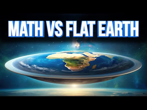
Flat earthers would like to have a word with you
@Mrssandypeterson Says:
So the object is out of sight, what happens when you then pick up binoculars?
@adamreynolds3863 Says:
damn it. i thought i was a globe earth thinker...but at 2:00 mark i realized i wasnt. now i am
@danmilew Says:
I’ve been watching his other videos for so long but I did not even know this channel existed
@xenontesla122 Says:
8:18, Fun fact: There is no top of the map. The actual 90th parallels are at infinity and the map is always cropped.
@Buphido Says:
Oh. My god. This just finally explained Eulerian vs Quaternian rotation to my brain! xD In Eulerian, you would rotate about the axis connecting the poles, which gives the lines of latitude. But if you actually wanted to take a straight route, which quaternions are great for, it’d be different from that line, as the axis of rotation isn’t the rotational axis of earth but rather the normal to the two points you want to travel between!
@libertycowboy2495 Says:
But...thought God would show up wearing shades. .........almond?
@dvision4203 Says:
Ooooooh because earth’s axis is tilted 23.4 degrees
@kryptoid2568 Says:
3:48 I see Yugoslavia
@foolish415 Says:
makes you wonder. how do things like radio waves go over the earths curve, if they have to stay in a straight line. i guess in the Y direction.
@Maree_CK Says:
I crossed the equator in Indonesia on a boat a few years ago. There was no red line. Very disappointing. 1/10.
@theastuteangler Says:
Whoa whoa whoa, hold on a minute. Flat Earth said...
@j.n.-fr5uh Says:
"that will be the topic of an upcoming video" when
@tobybartels8426 Says:
A correction about the North and South Poles on the Mercator map. They're not just reduced to single points; they're also (because of the yhdistortion) infinitely far away. You drew the North Pole as if it were at only a finite y-coordinate, so the diagonal rhumb line eventually hits it. But actually, it's infinitely far away so that the rhumb line will go around and around infinitely many times before hitting it. That's why rhumb lines don't just reach the poles; they spiral into the poles, going around them infinally many times before hitting.
@shrankai7285 Says:
Nice video!
@Kaviranghari Says:
surprisingly, his science content is also good.
@Daviticus042 Says:
"Let's say you were standing in Lisbon, Portugal and had a super powerful catapult and wanted to hit Washington, DC as many people do."🙂
@edwardsimpson119 Says:
0:05 What is this I don't even...
@ernestooscarpatrono9070 Says:
I love your voice
@wasted3secondsreadingmyuse30 Says:
Is no one gonna talk about the “wanna hit Washington DC as many people wanna do” joke?
@CallOfCutie69 Says:
4:27 looks like a Poincare disk…
@ketsuekikumori9145 Says:
I keep expecting a flat earth joke. Like Zach is trying to explain non-euclidian geometry to a flat earther. Actually, similar to how you did the invention of numbers, you should definitely do a skit where a non-euclidean geometrist (if that's a word) is trying to explain is worldview (pun intended) to an euclidean geometrist.
@driptcg Says:
Nice video
@alitheeternity4230 Says:
5:00 IN FLERF NEWS,
zach star says flat earthers are absolutely correct and neil degrasse tyson is ......
Juat annoying.
@alitheeternity4230 Says:
4:04 ah yes the annoying wind.
@johnsavard7583 Says:
Not azimuthal equidistant to find a true great circle path, because that would show the equator isn't a great circle. Instead, think of one where the equator isn't on the map, but at infinity. The gnomonic projection is the one you have to use.
@lilyzheng2322 Says:
I thought of flat earth didn’t know you would
@xxslayer255xx Says:
Great video but it all hinges on the assumption that the earth isn't flat. Would've liked more discussion on that topic
@ImPuLsE93 Says:
I wasn't expecting a serious educational video... good stuff.
@okaro6595 Says:
There is no North Pole in the Mercator projection as it would be infinitely far away. It has to be cut at some point. Once you go fair enough a single snow flake will cover the entire width. Typically it is cut so that only the tip of the Greenland is shown.
@okaro6595 Says:
Only Americans use the Mercator projection.
@FanTazTiCxD Says:
The way Zach speaks, you constantly think he is trying to be sarcastic or mocking something, and the joke is just about to be delivered in a moment... You have to keep reminding yourself, that this is not the channel where he makes fun of stuff
@michaelchen6739 Says:
A bunch of mumbo jumbo
@jtgd Says:
1:09 hmmm. Whats the earth’s tilt in degrees again?
@PastPresented Says:
7:04 Measuring the angles of celestial bodies relative to the horizon predated the sextant by many centuries. Most used the principle of a weighted pointer moving against a curved protractor-style scale, though a device called a cross-staff relied on perspective instead, which helped to nullify the effects of the ship's rolling motion.
@Bob-xv6un Says:
You should remember, that Magnetic Pole(compass) is not the same as Geographical Pole(pole on map). Not only it's not the same, but also magnetic field is constantly changing it's position(you can find it's route for the past centuries online). That's why all modern compasses in planes and ships are gyroscopic and require electricity. So, you should take it into account when planning very long routes(if going to use magnetic compass) for thousands of kilometres and make appropriate corrections. That is why old sailors vere relying on stars more then on compass.
@josephhobbs4680 Says:
How are you getting along with algebraic topology?
@frusie91 Says:
Much better Zach! This type of content
@miguelbatista535 Says:
Lisboa mentioned Caralho❤
@pierfrancescopeperoni Says:
This was so funny 😂
@thatsmyopinion406 Says:
Zach's videos are a gold mine, so rare and awsome to find.
@Zandezz. Says:
Glad to see you upload to the second channel again
@shashanksam Says:
thanks for the amazing video, loved it
@VictorPenteado Says:
You guys cannot imagine how is to live in a southern country and having to deal with people pulling out their hair and saying that Mercator was made by the europeans to made them look bigger and subjugate other countries, and that shitty Peters projection is the "right one".
@Gibon345 Says:
They are all fake because the earth is flat
@I.____.....__...__ Says:
I thought this video was going to be Yet-Another-YT-Video-About™ map projections and how they're all inaccurate. I was pleasantly surprised that this video was actually something more than the usual and had a novel and interesting take on the concept that actually grabs your attention and makes you think. 👍
@LeventK Says:
Once I have heard the reason why we use this technique is because it makes Africa look small, so the starvation there is underestimated. Feels like a conspiracy theory but idk
@rrvindu Says:
I forgot he’s actually an engineer other than being a great comedian


LATEST COMMENTS